Posts

Showing posts with the label Waitemata

To Cross the Waitematā [Auckland Harbour Bridge Part 2]
Image
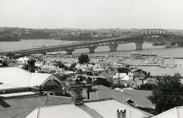
 Opened in 1959, the Auckland Harbour Bridge is a distinctive and crucial piece of infrastructure. The incident in September 2020 when a truck was tipped over by a strong wind gust, causing damage to the bridge structure and creating traffic chaos, showed how reliant we are on our main harbour crossing. Currently, Waka Kotahi NZ Transport Agency and Auckland Transport are looking at alternative harbour crossings. Some of the suggestions mentioned in the media, including a proposal for a tunnel under the harbour are not exactly new ideas. In fact, the first proposal for a harbour bridge dates to 1860, and the topic was raised many times in the century that followed. Auckland’s traffic woes and the debate about how efficiently to move people across the Waitematā Harbour is an age-old issue which can be seen in various documents held in the Archives. Image: St Mary’s Bay looking towards Auckland Harbour Bridge, 1981 (Auckland Council Archives, Auckland City Council photographic depart...
Auckland's waterways

Image
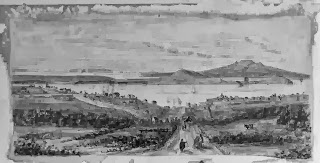
Ref: 4-4589, drawing looking north from Grafton Rd towards the harbour, showing Grafton Road ( foreground), Symonds St, (left), Mount Victoria, North Head & Rangitoto in the distance, c. 1886, Sir George Grey Special Collections One of the themes for the heritage festival is Auckland’s waterways, including the land and sea. The events focused on this theme celebrate water and its many guises in the Auckland region, including as a source of travel, trade, economy, recreation and more. Ref: JTD-05J-03077-2, two women sitting on a swing plank bridge over the Opal Pools Stream, 1942, West Auckland Research Centre Auckland's geography and its waterways have intimately influenced the history of the region. The Auckland isthmus was a rich and desirable location for Māori for many reasons including the rich volcanic soils for gardening and the coastal resources. Ref: B0336, James Stanley Levesque picking tomatoes from the Levesque tomato beds, Birkdale, c. 1920s, from Bir...

Signing the Treaty of Waitangi in the Auckland area

Image
On 6 February 1840 the Treaty of Waitangi was signed in the Bay of Islands. Lieutenant-Governor William Hobson afterwards circulated copies of the treaty for signature by other chiefs throughout New Zealand. Over the next few months five or six treaty meetings were held in the Waitemata and Manukau areas. Image: Captain William Hobson, circa 1835. Auckland Libraries Heritage Collections 5-0205. The first of these was held during Hobson’s first visit to the Waitemata, on 4 March 1840. The exact location is uncertain, but was probably Karaka Bay, and if not Karaka Bay then certainly somewhere along the shoreline between the Tamaki River and Maraetai. Sixteen Ng āti Paoa, Ng āti Maru and Ng āti Tamater ā – and perhaps also Ngai Tai – chiefs signed a copy on this occasion, with Captain Joseph Nias and the missionaries Henry Williams and William Fairburn acting as witnesses.