Posts

Showing posts with the label Auckand Harbour Bridge

Portal to a brighter day [Auckland Harbour Bridge Part 3]

Image
From 1955 to 1959, Aucklanders watched as a bridge gradually began to take shape across their harbour. The Waitematā, beautiful and usually so serene, was transformed into a stage for one of the largest and most complex construction projects in New Zealand’s history. Those on the quiet North Shore were particularly affected. Where residents of Northcote Point might once have looked over a tranquil harbour scene to the city on the opposite shore, their view now bustled with building activity. For those who lived in close proximity, excitement about the construction might quickly have worn off, but for plenty of Aucklanders, the project’s progress was a matter of ongoing fascination. In 1957, a watchman at the Northcote building site reported that as many as 50 sightseers would clamour to the area during weekends. Much larger numbers visited on the city side. Image: Jack Kirk. Aucklanders look on as the pick-a-back span is moved into place, 1958. Auckland Libraries Heritage Collections, ...
To Cross the Waitematā [Auckland Harbour Bridge Part 2]

Image
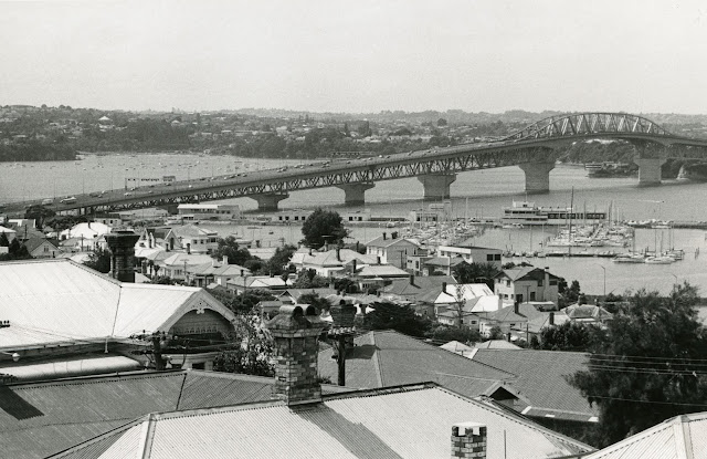
 Opened in 1959, the Auckland Harbour Bridge is a distinctive and crucial piece of infrastructure. The incident in September 2020 when a truck was tipped over by a strong wind gust, causing damage to the bridge structure and creating traffic chaos, showed how reliant we are on our main harbour crossing. Currently, Waka Kotahi NZ Transport Agency and Auckland Transport are looking at alternative harbour crossings. Some of the suggestions mentioned in the media, including a proposal for a tunnel under the harbour are not exactly new ideas. In fact, the first proposal for a harbour bridge dates to 1860, and the topic was raised many times in the century that followed. Auckland’s traffic woes and the debate about how efficiently to move people across the Waitematā Harbour is an age-old issue which can be seen in various documents held in the Archives. Image: St Mary’s Bay looking towards Auckland Harbour Bridge, 1981 (Auckland Council Archives, Auckland City Council photographic depart...

A Bridge Too Far? [Auckland Harbour Bridge Part 1]

Image
Sunday, 31 May 1959 marked a turning point in the history of Tāmaki Makaurau. After a century of dreaming, campaigning, planning, and politicking, a bridge finally connected Auckland City to the North Shore of the Waitematā. Throughout that time, ten formal proposals were submitted to local councils or the Government, at least as many bridge and tunnel designs were sketched, and endless amounts of ink were spilled arguing the topic on paper. However, the history of a bridge across the Waitematā does not begin with an ambitious Pākehā proposal published in a newspaper; rather, its origins are a narrative passed down through the generations from the earliest Māori who called the Tāmaki isthmus home. Image: Whites Aviation. View of Westmere with Meola Reef stretching across the Waitemat ā at low tide, May 1946. Auckland Libraries Heritage Collections 580-ALB22-026.   A long time ago, there was a war on the Waitematā between two iwi of the night-dwelling, fairy-like patuapaiarehe....

Whites Aviation hand coloured photographs

Image
Whites Aviation produced hand coloured photographs of New Zealand for around fifty years. When they began in 1945 colour photography wasn’t accessible as it was only in its infancy so the hand coloured photographs they sold were very popular. These now iconic images can be found in cafés like Replete i n Taup ō  o r Vudu in Queenstown. This very large photograph that was recently donated to the library is 1100 x 2520 millimetres and formerly hung in the Auckland Star building. Ref: Whites Aviation, Auckland, c1965, Sir George Grey Special Collections, Auckland Libraries, 1411-1.

Summer Holidays

Image
The few weeks over Christmas and New Year are a popular time for many in New Zealand to take some time off from work and, weather permitting, enjoy some fun in the sun. So whether you’re working through the summer holidays, at the bach or even in a different hemisphere we hope you enjoy this collection of images of New Zealand summer holidays. Last week we wrote about the interesting story behind the Riverhead Dump photograph collection . All of the images in this post are also from that collection.  Ref: Sports car, Sir George Grey Special Collections, Auckland Libraries, 1055-136. Ref: Auckland Harbour Bridge, 1960s, Sir George Grey Special Collections, Auckland Libraries, 1055-109.

Auckland's waterways

Image
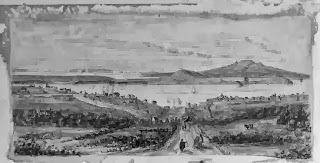
Ref: 4-4589, drawing looking north from Grafton Rd towards the harbour, showing Grafton Road ( foreground), Symonds St, (left), Mount Victoria, North Head & Rangitoto in the distance, c. 1886, Sir George Grey Special Collections One of the themes for the heritage festival is Auckland’s waterways, including the land and sea. The events focused on this theme celebrate water and its many guises in the Auckland region, including as a source of travel, trade, economy, recreation and more. Ref: JTD-05J-03077-2, two women sitting on a swing plank bridge over the Opal Pools Stream, 1942, West Auckland Research Centre Auckland's geography and its waterways have intimately influenced the history of the region. The Auckland isthmus was a rich and desirable location for Māori for many reasons including the rich volcanic soils for gardening and the coastal resources. Ref: B0336, James Stanley Levesque picking tomatoes from the Levesque tomato beds, Birkdale, c. 1920s, from Bir...